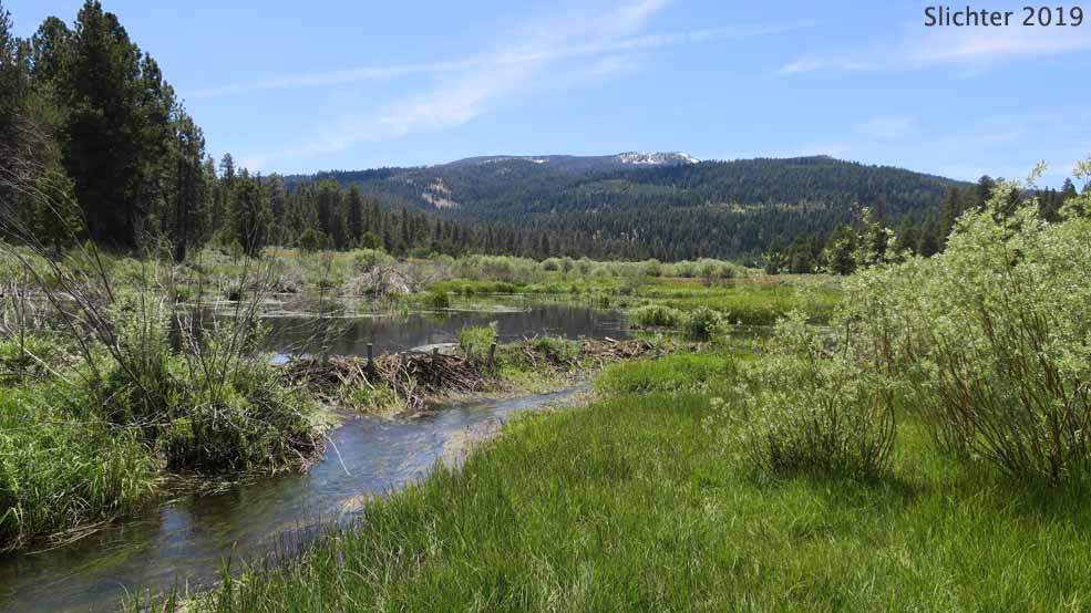
Crane Mountain is near the northern end of the Warner Mountains, an 85 mile fault block range at the northwestern corner of the Basin and Range Province in NE California and south-central Oregon. At 8347', it is the highest part of the Warner Range in Oregon. Access to the summit is by the Crane Mt.Ttrail from the east or the Crane Mountain National Recreation Trail #161 from the north or south. In average snowfall years, the summit is accessible from about the Fourth of July on into late fall. Be sure to call the Lakeview Ranger Station for snow condition reports if you plan to hike here earlier than mid-July.
Crane Mountain provides access to a number of California wildflower species which locally extend northwards only near the mountain. If hiking the Crane Mountain Trail, then keep an eye out for wildflowers along Forest Rd 3915 where one can find narrow-leaf onion (Allium amplectens), flatstem onion (Allium platycaule), Fremont's wild buckwheat (Eriogonum nudum var. pubiflorum), Roezl's penstemon (Penstemon roezlii), Rydberg's penstemon (Penstemon rydbergii var. oreocharis), California valerian (Valeriana californica), plantain-leaved Eaton's fleabane (Erigeron eatonii var. plantagineus), yarrow-leaved Oregon sunshine (Eriophyllum lanatum var. achilleoides), woolly mule's ears (Wyethia mollis) and many others.
Plants to Expect to See Along This Hike:
Along the Road: Rock spiraea (Holodiscus microphyllus var. glabrescens), king's clover (Trifolium productum), sticky geranium (Geranium viscosissimum var. incisum), toothed wintergreen (Pyrola dentata), western morning glory (Calystegia occidentalis ssp. occidentalis), nettle-leaf horsemint (Agastache urticifolia var. urticifolia), wavy-leaf paintbrush (Castilleja applegatei var. pinetorum), slender penstemon (Penstemon gracilentus), California valerian (Valeriana californica), heartleaf arnica (Arnica cordifolia), arrowleaf balsamroot (Balsamorhiza sagittata), and woolly mule's ears (Wyethia mollis) and many others.
At the Summit: Parsnip-flower buckwheat (Eriogonum heracleoidies), Sierra buckwheat (Eriogonum marifolium var. marifolium), Goose Lake wild buckwheat (Eriogonum strictum var. anserinum), cliff woodbeauty (Drymocallis pseudorupestris var. saxicola), spreading phlox (Phlox diffusa), western mountain balm (Monardella odoratissima), cobweb paintbrush (Castilleja arachnoidea), Davidson's penstemon (Penstemon davidsonii var. davidsonii), lanceleaf hotrock penstemon (Penstemon deustus var. pedicellatus), mountain kittentails (Veronica missurica var. missurica), discoid goldenweed (Ericameria discoidea) and silvery raillardella (Raillardella argentea).
Drive 5 miles north from Lakeview on US Highway 395. Turn right onto Oregon Highway 140 heading east towards Adel, OR. After climbing to the Warner Mountain Summit, descend to Camas Prairie on the right, passing much of it before arriving at the only major 4-way intersection, turning right (south) onto Forest Road 3915. Camas Snopark and FS Road 3615 (to Bull Prairie and Drake Peak Lookout) will be on the north side of this junction.
Proceed south on Rd 3915 about two-thirds of a mile and turn right (west), driving about a mile and a half before turning left and cross Camas Creek on a bridge. Continue south on Rd 3615 into the forest, eventually arriving at a 4-way junction with FS Road 3910. The Rogger Meadow Trailhead will be on the right (west) side of this junction. There's a vault toilet there if needed, and that trailhead is used to access the Crane Mountain Trail #161 and provides a loop trail around Rogger Peak.
Continue driving south on Rd 3915, eventually descending to Willow Creek Meadows where you turn right onto FS Rd 4011 (signed for Willow Creek CG). This will be about 8-9 miles south of OR 140. In about half a mile you pass Willow Creek Forest Camp (pit toilets, picnicing and camping). Continue uphill on Rd 4011 which becomes spur road 015. Continue to a wide spot where vehicles can turn around and park. This is an unofficial trailhead. High clearance 4WD vehicles can continue to the top. Possibly, an AWD vehicle like many Suburus could drive to the top, but there are places with shrubbery hanging in to the roadway where you could scratch up your car. Although lightly used (except during holidays), it's best not to park where vehicles would turn around. There is no water or pit toilets at the trailhead, and we found no signage there in June 2020. Note: This is not the trailhead that the USFS has published (below) on it's website. When you talk to the staff at the Lakeview Ranger District office about hiking Crane Mt., they will assume you will be hiking from their official trailhead which can potentially be hiked, but is mostly used as a motorized vehicle trail.
Expect a drive of an hour and 15 minutes to where you park, without stops.
Note: This trail and and the Crane Mt. National Recreation Trail #161 is used by high clearance vehicles. Otherwise, the trails are also used by hikers, mountain bikers and hikers. Mid-week use is light, but holiday use is probably high.
August 1, 2020: Crane Mountain via Spur Road 015 at the end of FS Road 4011.
Crane Mountain National Recreaton Trail #161 - Includes links to the main trailheads for this trail. Contains general information from the Fremont-Winema National Forest website.
Crane Mountain Trailhead - information from the Fremont-Winema National Forest website about the alternative trailhead for Crane Mountain.
Crane Mountain (OR) - summitpost.org writeup
Crane Mountain OHV - RiderPlanet USA, Motorcycle and ATV Trails Database - I found the map (provided above) to be useful.
100 Hikes in Oregon, by Rhonda & George Ostertag (1992- the Mountaineers) - Provides a general description of the route and what you'll see, though I think the access directions have changed somewhat since this was published.
Exploring Oregon's Wild Areas: A Guide for HIkers, Backpackers, Climbers, X-C Skiers & Paddlers by William L. Sullivan (mine is a second edition...don't know if there are later editions or not). - Contains info on hiking Crane Mt., Abert Rim, Gearhart Wilderness and Hart Mountain.